Offering virtual and aerial updates for your residential and commercial projects in the Okanagan.
Stay up to date on your projects wherever you are, on a weekly, bi-weekly, or monthly basis.
Stay up to date on your projects wherever you are, on a weekly, bi-weekly, or monthly basis.
AI Virtual Imaging
(interactive - click and drag around, scroll or pinch to zoom)
|
|
|
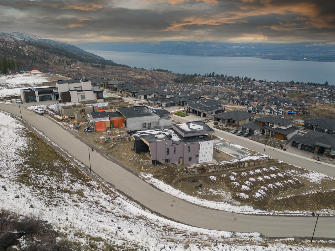
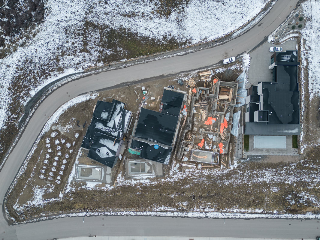
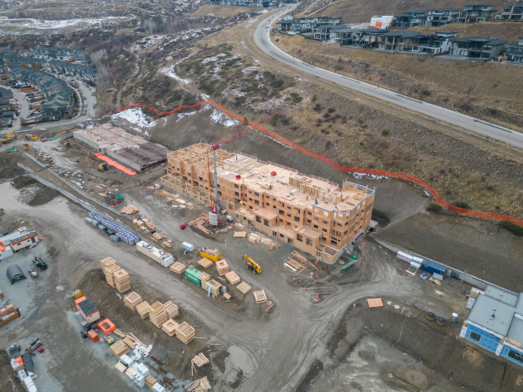
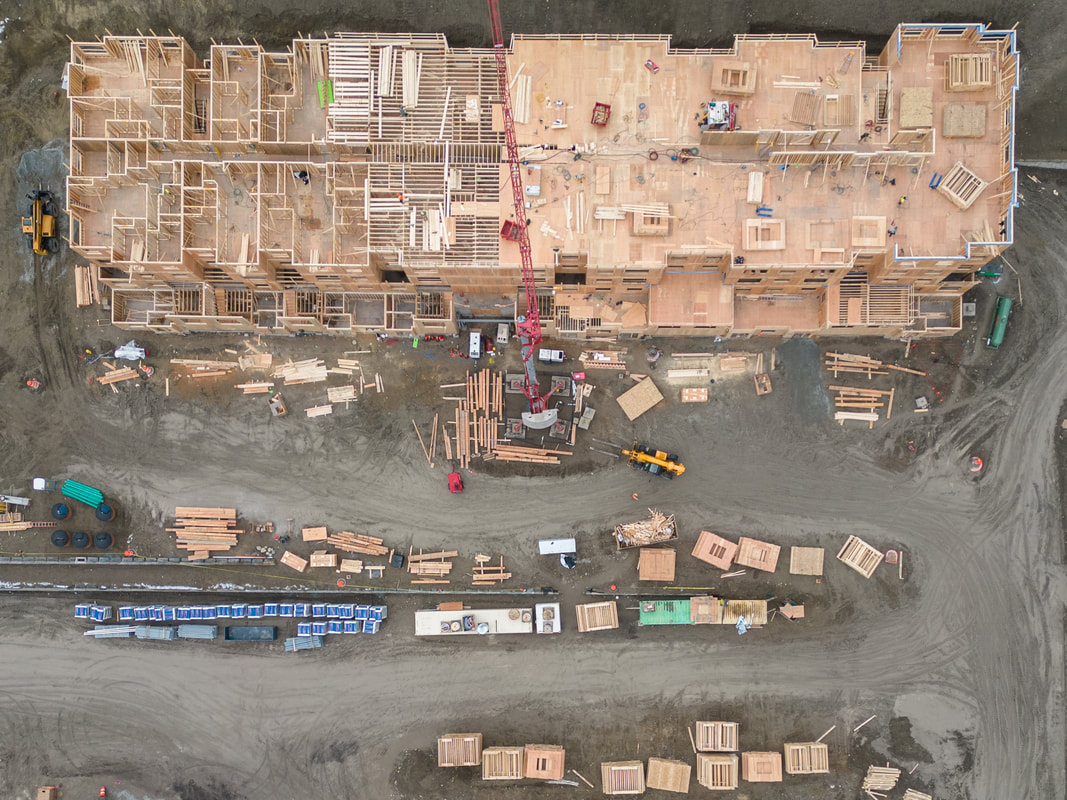
Aerial Photo & Video Updates
How it works:
What's in it for you?
These high-quality images and video captured from above provide valuable insights and contribute to the success of such ventures in several ways:
- Flat fee pricing for each update
- Each package includes a virtual AI model, aerial images, and video
- Add-ons of interior photos and 360 walkthrough video available
- Weekly, bi-weekly, monthly, or custom timeline updates to suite your needs and the pace of your build
What's in it for you?
These high-quality images and video captured from above provide valuable insights and contribute to the success of such ventures in several ways:
- Site Analysis and Evaluation:
By regularly updating aerial photographs, developers can monitor changes in the project site over time. This allows for effective analysis of land use, environmental conditions, and infrastructure development, helping in the assessment of potential risks and opportunities. - Progress Monitoring:
Aerial updates enable real-time monitoring of construction progress. This helps project managers track the implementation of plans, identify any deviations, and ensure that timelines are adhered to. It also facilitates better communication among stakeholders by providing a visual representation of the ongoing work. - Marketing and Promotion:
High-quality aerial imagery is a powerful tool for marketing and promoting commercial and residential developments. These visuals showcase the project in its entirety, highlighting key features and amenities. Such images are often used in promotional materials, websites, and presentations to attract investors, clients, and buyers. - Environmental Impact Assessment:
Aerial photography aids in assessing the environmental impact of development projects. By capturing the surrounding ecosystem and terrain, it becomes easier to identify areas that need protection or restoration, ensuring compliance with environmental regulations and sustainability goals. - Property Valuation:
Accurate and up-to-date aerial imagery contributes to better property valuation. It provides a comprehensive view of the property and its surroundings, helping appraisers and investors make more informed decisions about the market value of the developed or developing land. - Risk Management:
Aerial updates assist in identifying potential risks and hazards on and around the development site. This proactive approach enables developers to implement risk mitigation strategies early in the project, ensuring the safety of construction workers and minimizing unforeseen challenges.